Upgraded infrastructure for active transportation
Three major upgrades to cycling and pedestrian networks in the City of Vancouver have created a seamless active transportation corridor running from the city's western neighbourhoods and across the Burrard Bridge to the downtown core. Active transportation is now safer, thanks to the Seaside Greenway, South End Burrard Bridge and York Bikeway projects, which have led to an increase of 20,000 new cycling trips per year.
Read the case study below to learn about project highlights, as well as the challenges and lessons learned that can help your community in planning similar projects.
About the project
| Municipal population | Project duration | Total project value |
|---|---|---|
| 603,502 | December 2012–June 2014 | $12 million |
Setting a new high water mark for active transportation infrastructure and healthy communities, the City of Vancouver has dramatically improved cycling and walking connectivity throughout a major waterfront corridor running from Vancouver's western neighbourhoods to its downtown core.
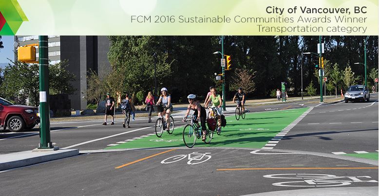
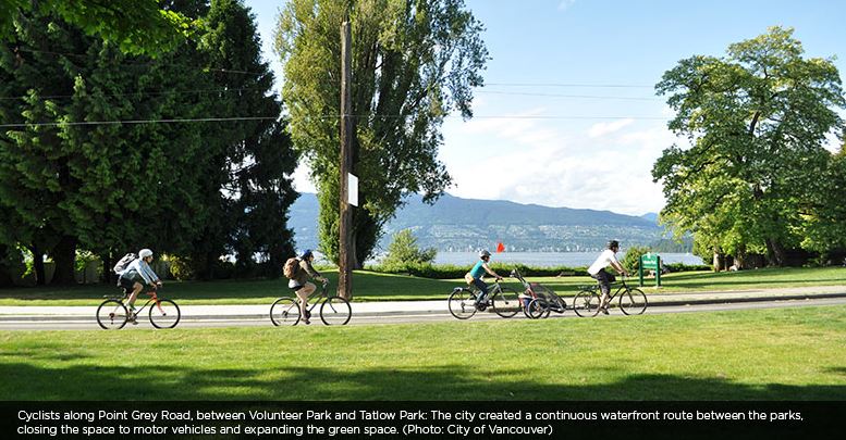
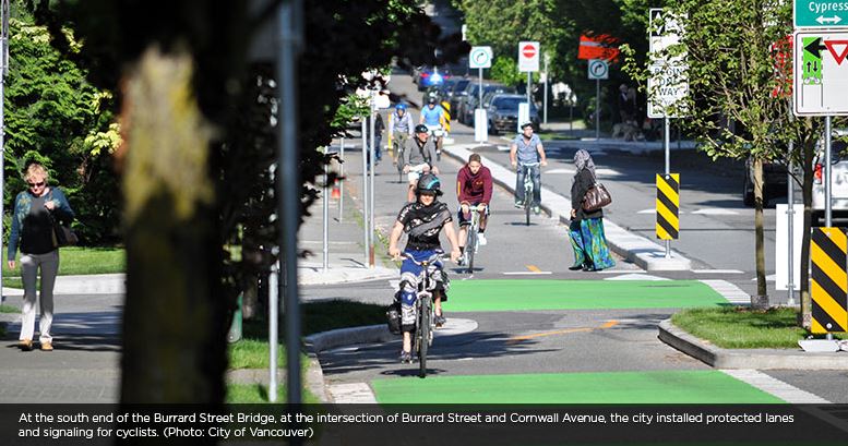
The entire 28-kilometre Seaside Greenway route is now a seamless, safe corridor for cyclists and pedestrians. The city closed a three-kilometre gap in the Seaside Greenway (the Seawall), where pedestrians and cyclists previously had to travel along busy Point Grey Road, by redirecting traffic and converting the road into a quiet greenway. The city also created the York Bikeway to extend the cycling corridor to the Burrard Bridge. The bikeway features protected bike lanes, bicycle signals and alternating one-way streets to calm traffic. The city also reconfigured the intersection at the southern end of the Burrard Bridge, making it simpler and safer for cyclists, pedestrians and motorists. With Dutch design features such as protected road space for cyclists and protected signal phases, it is now one of the most complete multi-modal intersections in North America.
The projects have enhanced waterfront access and sustainable transportation opportunities for people of all ages and abilities. They help to fulfill the city's Transportation 2040 goals, and they contribute to Partners for Climate Protection (PCP) Milestone 5 (corporate and community).
"People in the city are now realizing that walking or riding a bike is an extremely viable option to getting into their car, whether it's for work, play, shopping or whatever else they are doing around the city."
— Councillor Heather Deal
Project Highlights
Results
| Environmental | Economic | Social |
|---|---|---|
|
|
|
Challenges
- It took time for the city to identify and agree on the best model for the intersection at the south end of the Burrard Bridge, because the chosen design was a new type of intersection for North America.
- To calm traffic on Point Grey Road, the city installed a permanent diverter that could not be moved. When adjustments were needed to accommodate changes in traffic patterns, the city had to install an additional diverter.
- City staff had to reconcile manual "before and after" counts. The city did not install automatic bicycle count equipment in time to track the beginning of heavy ridership over the summer. Additionally, the city could not use automatic equipment to track bicycle trips prior to construction, because bicycle traffic was mixed with motor vehicles.
Lessons learned
- Be bold and courageous: build on the momentum and support generated during municipal planning efforts by taking on "hard-to-do" projects right away once long-range plans are established.
- When altering streets and intersections to better accommodate cyclists and pedestrians, draw individual elements from best practices in other jurisdictions to create unique configurations tailored to local needs.
- Apply the new model to a whole corridor or network of streets, rather than imposing the change on a single street or intersection. This increases the impact and the likelihood of successful uptake.
- Conduct continual network monitoring in various forms (including traffic cameras and trip count equipment) to measure results and inform ongoing adjustments.
More information
David Rawsthorne
Senior Transportation Engineer
City of Vancouver, British Columbia
T. 604-873-7343
Want to explore all GMF-funded projects? Check out the Projects Database for a complete overview of funded projects and get inspired by municipalities of all sizes, across Canada.


