
 Why does collecting data about community canopies matter?
  Key considerations for data collection and tool selection
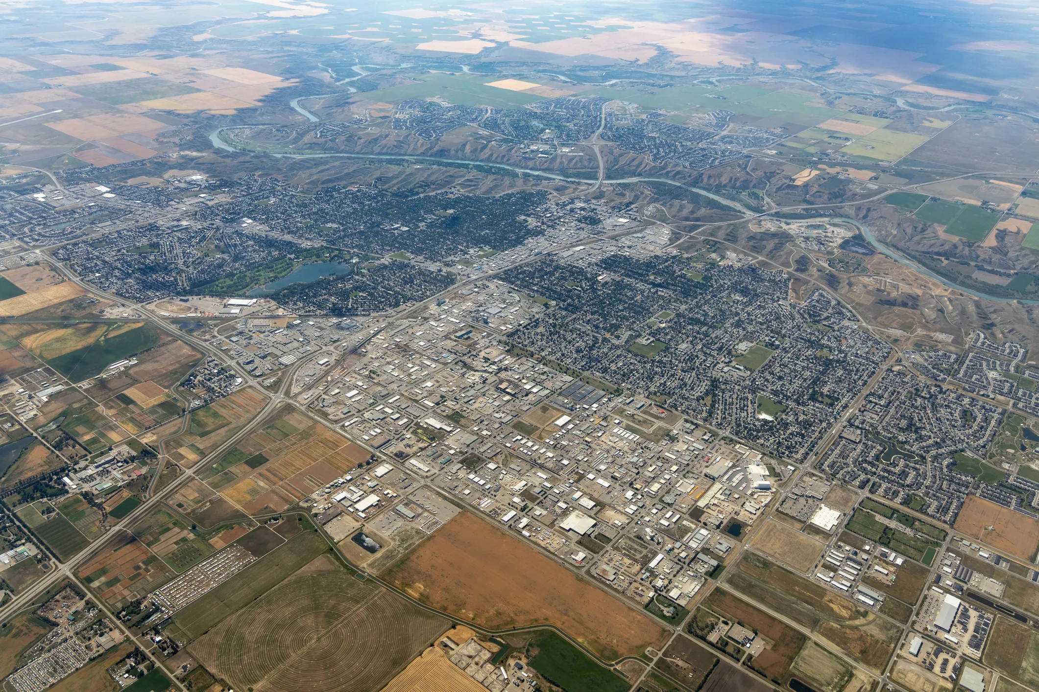
Factsheet: Urban forestry technology and tools
Which tools are right for your local context?
This factsheet discusses key technology and tools that your local government can use to measure, analyze and make decisions about its community tree canopy. It provides an overview of the different technologies and tools that can be used in urban forestry and how to decide which are most useful for your local context.
This factsheet was created to support small and rural communities who are just developing their urban forestry approaches and content might be helpful for municipal staff working in various departments such as public works, recreation or public health services.
Why does collecting data about community canopies matter?
In urban forestry, technology is changing the way communities manage their tree canopies. From geographic information systems (GIS) to light detection and ranging (LiDAR) technology, a suite of tools and software applications can provide data and analytical capacities that enable communities to map, monitor and maintain their urban forests with increasing precision and efficiency.
Data provides valuable insights into the current state of urban forests. For example, collecting data about how trees are distributed across a community helps identify where trees need to be planted, replaced or protected. This can be compared against canopy cover targets and used to explore equity in the distribution of canopy benefits or to assess the value of trees as natural assets. Data-driven approaches can also help illustrate the value of trees to the broader community, raising awareness and fostering support for conservation efforts and community engagement.
Key considerations for data collection and tool selection
Choosing the best tools for managing community canopies relies on understanding what data you need as well as a tool’s purpose, its technical capabilities and your budget. Different tools require different data inputs, so it’s best to select those that will help you generate the insights you need based on the data you have or can collect.
Here are some questions you can ask to help determine the most suitable tools for effective urban forest planning and management:
- What do you intend to use the tool for? How will it help you collect or interpret data about your community’s urban forest?
- What is the data input required for the tool you want to use? Does it have any hardware and/or software requirements?
- Will the tool work in your community or geographic region? Is it accessible to all stakeholders and rightsholders?
- How user-friendly is the tool? Is it easy to integrate with existing systems and workflows? Does it require any technical training? Is there any technical support for users?
- What are the tool’s initial investment costs? Are there ongoing maintenance and support fees? Is adopting it likely to create savings or efficiencies?
- Does the tool adhere to the community’s data security and privacy standards and ensure that sensitive information is well protected? Does the tool include any security measures or back-up protocols for data integrity and safety?
Technologies and tools for data collection and analysis
This section summarizes the key applications of technologies and tools that can be used to collect and analyze data for managing your community’s tree canopies.
Satellite or aerial imagery
Satellite imagery is collected by satellites orbiting the planet, operated by governments and businesses. Aerial imagery comes from photos taken from aircraft or other airborne platforms, such as drones. Orthophoto or ortho-imagery is a computer-generated image of an aerial photo that corrects any distortions due to terrain or camera angles.
Satellite or aerial imagery is commonly used to:
- Map tree canopy cover with a reasonable level of accuracy
- Understand the type, structure and health of a community canopy
- Detect tree canopy gains or losses and other land cover changes over time
- Measure land surface temperature and evaluate a community’s vulnerability to climate change
- Estimate tree canopy benefits, such as removal of carbon dioxide or air pollution
There are numerous data sources and tools that allow you to access and analyze satellite or aerial imagery. A few free examples include:
- Download imagery from the United States Geological Survey or European Space Agency
- View and analyze land cover imagery using Google Maps, Google Earth, Dynamic World, Esri Land Cover Explorer or i-Tree Canopy
Light detection and ranging (LiDAR)
LiDAR technology employs laser light to map ground surface, such as trees and buildings, from the air. It is one of the most accurate remote sensing techniques to collect data on terrain and any features on the Earth’s surface.
LiDAR technology is commonly used to:
- Map tree canopy cover
- Estimate tree count
- Understand structural attributes (e.g., tree height)
- Map impermeable and permeable surfaces (e.g., as potential planting spaces)
LiDAR requires purchasing data, possibly paying for software and technical training or consulting services for data processing. LiDAR data should be collected during leaf-on seasons to accurately estimate tree canopy cover.
Geographic information systems (GIS)
GIS is a technology platform used to capture, store, manage, analyze and visualize spatial and geographic data. GIS can integrate various types of data into a single digital environment, such as maps, satellite imagery, aerial photos, demographic information and tree inventory data. This helps users explore, interpret and understand spatial relationships and patterns.
GIS technology is commonly used to:
- Map, calculate and display tree canopy cover
- Map, analyze and display selected features or patterns of interest (e.g., parks, deciduous trees or accessibility of green spaces)
- Collect, store and manage tree inventory data
- Understand urban forest distribution and tree equity
- Share information and engage with stakeholders or rights holders via GIS-based interactive platforms
Technical training or hiring personnel with experience using GIS programs may be required. Most programs require a paid subscription. GIS programs range from general software applications to specialized applications that can help you share information and engage stakeholders, collect tree inventory data, or store, display and manage tree inventory data.
You can also use GIS technology to analyze and display other types of data that may inform your urban forest management plan. For example, mapping temperature data to identify areas prone to the urban heat island effect can influence decisions about where to plant new trees.
Emerging technologies and tools
Drones (unmanned aerial vehicles)
Drones, also called unmanned aerial vehicles (UAVs), are increasingly being used in urban forestry to collect detailed data such as high-resolution photos and thermal infrared imagery. UAVs’ ability to gather site-specific information quickly and cost-effectively makes this emerging tool a valuable one for monitoring tree health and conducting tree inventories and rapid assessments in urban areas.
Street-view imagery
Street-view imagery is another emerging data source for understanding urban landscapes from a human perspective, complementing remote sensing methods like LiDAR. It is increasingly studied and used to assess near-street greenery, assist in tree inventory when resources are limited and engage the public.
Ground-based sensors
Ground-based sensors like thermal imaging, soil moisture and acoustic sensors are increasingly being used to monitor urban forest parameters and site conditions. They can provide detailed information on tree health and environmental factors crucial for healthy tree growth.
Data management and decision-making tools
 Data management and decision-making tools
 Data-management and decision-making tools are designed to display information and assess performance over time, allowing local governments and communities to evaluate the current conditions of the urban forest, monitor progress and trends, and make informed decisions to improve outcomes.
There are numerous applications that can be used to evaluate the performance of your urban forest management program against established best practices and benchmarks. For example:
- Vibrant Cities Lab has developed a Community Assessment and Goal-Setting Tool for tree canopies that can be used to benchmark, measure against best practices and monitor progress over time.
- Sustainable Forestry Initiative has developed an Urban and Community Forest Sustainability Standard to guide and evaluate the sustainability efforts of organizations managing urban or community forests.
- NatureScore, developed by NatureQuant, measures the amount and quality of natural elements at any location and their potential health impacts using a unique system that incorporates satellite data, GIS classification, park features, tree cover, pollution levels and machine-learning algorithms.
Opportunities to involve the community
Deciding on which tools and technologies to use is largely dependent on your data needs, priorities and budget. However, there may be opportunities to involve the broader community in data collection and analysis, such as working with volunteers, academic institutions or other research groups. Citizen science applications like iNaturalist allow community members to record and share observations on local plants and animals, which can inform decision-making about the urban forest.
Community engagement can help you set priorities for your analysis by understanding which tree canopy characteristics are valued by the community and therefore important to track and report on. The use of different technologies to display and communicate information about your local tree canopy can also be an important part of broader engagement strategies around the benefits of trees.
Next steps
Here are additional resources that can help you get started with selecting tools and technologies:
- Tree Canada, Compendium of Best Urban Forest Management Practices: Chapter 7. GIS and Other Technologies
- Nature Canada, Canada’s Urban Forests: Bringing the Canopy to All
This resource was created in partnership by Tree Canada and FCM’s Green Municipal Fund for the Growing Canada’s Community Canopies initiative, which is delivered by the Federation of Canadian Municipalities and funded by the Government of Canada.

Related Resources
See All
Video
 Trees
Trees
 Forestry
Video: How Kitchener is scaling up its urban canopy cover
This case study portrays how the City of Kitchener,ON is expanding its urban canopy while improving climate resilience, biodiversity and tree equity across communities.
Tool
Trees
Forestry
Template: Create a tree maintenance and monitoring plan
This template will help you develop a comprehensive maintenance and monitoring plan for your urban forestry project.
Webinar recording
Trees
Forestry
Webinar recording: Biodiversity strategies for resilient urban forests
Discover how practices like planting native tree species fosters biodiversity, builds climate resilience and promotes healthier communities.
Tool
Trees
Forestry
Factsheet: Tree monitoring
This factsheet explains why tree monitoring is an essential part of tree planting projects and how to set up an effective monitoring program.
Guide
Trees
Forestry
Guide: Creating an urban forest management plan for your community
Learn how to plan and manage your community’s urban forest.
Case Study
Trees
Forestry
Why communities of all sizes benefit from urban forestry coaching
In this article you’ll discover common urban forestry challenges communities face and how GCCC’s network of urban forestry coaches can help.
Tool
Trees
Forestry
Tip sheet: Community engagement in urban forestry projects
Learn effective strategies to engage communities in your urban forestry project.
Webinar recording
Trees
Forestry
Webinar recording: Develop an urban forest management plan for your community
Watch this webinar to learn how an urban forest management plan can benefit your community.
Tool
Trees
Forestry
Tip sheet: Maximizing the climate resilience benefits of tree planting projects
Learn strategies to strengthen the climate resilience benefits of your tree planting project and how to effectively communicate these benefits
Tool
Trees
Forestry
Tip sheet: Communicating tree planting biodiversity benefits
Learn how to effectively communicate the biodiversity and ecosystem health benefits of your tree planting project
Webinar recording
Trees
Forestry
Webinar recording: Urban forestry for every community
In this webinar, experts discussed how communities of all sizes can take the lead in urban forest management.
Tool
Trees
Forestry
Factsheet: Planting trees to restore and connect ecosystems
This factsheet explores how thoughtful tree planting and urban forest management can restore and connect habitats to enhance urban biodiversity.
Guide
Trees
Forestry
Guide and template: Create a tree planting plan for your community
Learn how to develop a comprehensive plan for your tree planting project.
Tool
Trees
Forestry
Resource: Join Growing Canada’s Community Canopies (GCCC) Community of Practice
Learn about how a Community of Practice can support your urban forestry efforts. Apply to join a collaborative network of municipal staff and their partners involved in urban forestry projects across Canada.
Tool
Trees
Forestry
Factsheet: Advancing tree equity and growing community canopies
Learn how to put tree equity at the centre of your urban forestry plans and practices.
Tool
Trees
Forestry
Factsheet: The role of tree diversity in strengthening urban forests
How tree diversity contributes to both climate resilience and urban biodiversity.
Tool
Trees
Forestry
Factsheet: Making the case for trees in your community
Discover how you can build a strong business case to grow your community canopies.
Webinar recording
Trees
Forestry
Webinar recording: The business case for planting trees
Learn how communities can make the business case for planting and protecting trees.
Tool
Trees
Forestry
Factsheet: Tree stock selection
Discover key points to consider when choosing trees and shrubs for your local planting projects.
Tool
Trees
Forestry
Factsheet: Urban forest planning
Read up on why developing an urban forest plan is important for the long-term success of trees in your community.
Tool
Trees
Forestry
Factsheet: Tree maintenance
Explore tree maintenance processes and best practices.
Tool
Trees
Forestry
Factsheet: Site selection and preparation
Learn important considerations for choosing where to plant trees and how to prepare for planting in sites where conditions are less than ideal.
Tool
Trees
Forestry
Factsheet: An urban forestry overview
Learn about urban forestry, why it’s important and how increasing tree canopy cover can address climate change and social inequities.
Tool
Trees
Forestry
Factsheet: Tree planting process
This factsheet tells you how to plant trees to give them the best chance of survival. It provides instructions that communities can follow to get newly planted trees off to a heathy start.
Tool
Trees
Forestry
Urban forestry coaching
Expert advice to enhance your tree planting and urban forestry activities.